 +1 credit
| Version | Summary | Created by | Modification | Content Size | Created at | Operation |
|---|---|---|---|---|---|---|
| 1 | Zahra Ameli | -- | 3695 | 2022-04-03 20:11:10 | | | |
| 2 | Zahra Ameli | Meta information modification | 3695 | 2022-04-03 20:14:37 | | | | |
| 3 | Conner Chen | -165 word(s) | 3530 | 2022-04-06 04:51:10 | | |
Video Upload Options
Uncrewed Aerial Vehicles (UAV) constitute a rapidly evolving technology field that is becoming more accessible and capable of supplementing, expanding, and even replacing some traditionally manual bridge inspections. Given the classification of the bridge inspection types as initial, routine, in-depth, damage, special, and fracture critical members, specific UAV mission requirements can be developed, and their suitability for UAV application examined.
1. Types of Bridge Inspection
| Inspection Type | Scope and Mission |
|---|---|
| Initial (inventory) |
Provide all Structure Inventory and Appraisal (SI&A) data and determine baseline structural conditions and load capacity ratings
|
| Routine | Evaluate physical and functional condition of structure and ensure that service requirements are satisfied
|
| In-depth | Hands-on inspection to determine deficiencies not detectable by routine inspection
|
| Damage | Determine if a bridge requires load restrictions or closures or the extent of repair required.
|
| Special | Intended to monitor a known or suspected deficiency at a specific location
|
| Fracture critical member | A detailed hands-on inspection to detect cracks.
|
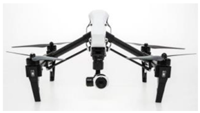
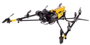
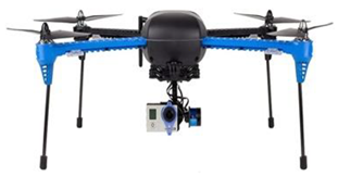
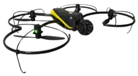
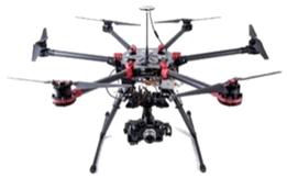
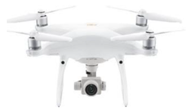
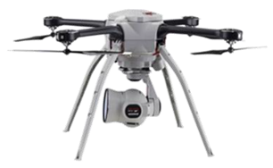
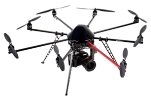
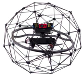
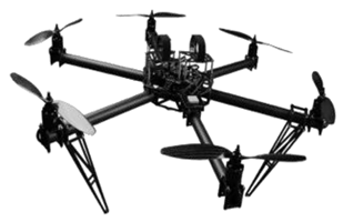
2. Developments of UAVs in Bridge Inspection in the US
 |
 |
 |
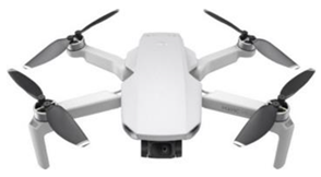 |
| DJI Inspire | Topcon Falcon 8 | 3DR Iris | DJI Mavic |
| Wisconsin DOT [7], Nebraska [15], North Carolina [16] |
Wisconsin DOT [7], Kentucky |
Idaho DOT [18] | Idaho DOT [18] |
 |
 |
 |
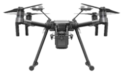 |
| SenseFly albris | DJI S900 | DJI Phantom | DJI M210 RTK |
| Oregon DOT [11], Vermont [17], Minnesota DOT [12] | Oregon DOT [11] | Oregon DOT [11], Alaska [19], Massachusets [13], Vermont [17] |
South Carolina [20] |
 |
 |
 |
 |
| Aeryon SkyRanger | Mikrocopter Hex | Flyability Elios | Cinestar |
| Minnesota DOT [12] | North Carolina [16] | Minnesota DOT [12] | Norht Carolina [16] |
3. Various Applications of UAV Mounted Sensors in Bridge Evaluation
▪ Surface crack detection: The majority of literature papers have addressed crack detection as the primary application of UAVs in bridge inspection [49]. The image-based surface crack assessment method consists of two main steps. The first step is crack detection, which intends to eliminate noise and extract crack objects from the images. The second step of crack assessment is the extraction of crack edges and calculating crack parameters, including crack width and length [50]. To detect bridge surface cracks, RGB cameras are typically used. The UAVs can capture high-quality images from hard-to-reach areas of the bridge [51][49] using optical cameras, but the distance from the structure surface, illumination condition, wind, and the minimum number of the required images are important considerations that need to be taken into account.
▪ Delamination: The horizontal debonding in the subsurface of the deck, known as deck delamination, often indicates the corrosion-induced deterioration of the deck reinforcement [52]. For the task of delamination profiling through thermography, the existing challenges are the shape and the depth of delamination, environmental factors such as air temperature and solar intensity, which introduces the feature variation of the same delamination, surface textures such as cracks, color difference, patching, and road painting, which adds external noise [53]. Image processing techniques were developed to extract temperature abnormalities automatically, quantitatively, accurately, and sensitively. This process mainly utilizes threshold temperature values and temperature gradients. The first challenge is determining threshold values because the values are affected by environmental conditions. The second challenge is difficulty in evaluating the entire target object by one global threshold value. The reason may be that the entire surfaces of infrastructures or buildings are not under the same conditions, and each local area has a different average temperature and gradient [54].
▪ Corrosion: Corrosion is a natural phenomenon involving an electrochemical process liberating a positive charge that becomes a stable compound. Although some corrosion occurs on the subsurface metal materials, such as the steel reinforcement used in concrete for bridges, a large amount of corrosion happens on the surface of steel bridges [55]. RGB and IRT cameras are commonly used for corrosion detection [56][57]. Infrared Thermography is a promising method of corrosion detection, measurement, and mapping, but more research needs to be done to perfect this method for use in the field [58].
▪ Fatigue: Fatigue cracks are very difficult to see and may have lengths shorter than 7 mm and widths narrower than 0.1 mm. Fatigue cracks normally appear in the superstructure near large cross frames, welded stiffeners, or other complex geometries, making access difficult. To detect fatigue cracks, RGB and IRT cameras are usually used [8]. Careful selection of a UAV platform, environmental conditions, and lighting conditions are important factors that affect UAV-based fatigue crack detection [59].
▪ 3D model reconstruction: To help bridge managers visualize the geometric information (e.g., damage location) and surface condition (e.g., damage type and extent) of an existing structure, 3D models of the structures are constructed to establish a base onto which damage information can be referenced. RGB cameras and LiDAR sensors can be implemented to generate 3D models [60]. In contrast to LiDAR, which usually contains more 3D points, photogrammetry uses a collection of 2D images taken from various angles and locations around the structure to create 3D points. Because photogrammetry matches image features to create the 3D points, there is a significant computational expense and less accuracy than LiDAR. However, the only equipment required for photogrammetry is an optical sensor, while UAV-based LiDAR systems require expensive LiDAR sensors and GPS systems, which decreases battery life by adding additional payload to the system [61].
References
- National Bridge Inspection Standards; Federal Highway Administration, Department of Transportation. 2004. Available online: https://www.govinfo.gov/content/pkg/FR-2004-12-14/pdf/04-27355.pdf (accessed on 1 April 2004).
- Tomiczek, A.P.; Whitley, T.J.; Bridge, J.A.; Ifju, P.G. Bridge Inspections with Small Unmanned Aircraft Systems: Case Studies. J. Bridge Eng. 2019, 24, 05019003.
- Dorafshan, S.; Thomas, R.J.; Coopmans, C.; Maguire, M. A Practitioner’s Guide to Small Unmanned Aerial Systems for Bridge Inspection. Infrastructures 2019, 4, 72.
- Jeong, E.; Seo, J.; Wacker, J. Literature Review and Technical Survey on Bridge Inspection Using Unmanned Aerial Vehicles. J. Perform. Constr. Facil. 2020, 34, 04020113.
- Moller, P.S. Caltrans Bridge Inspection Aerial Robot Final Report; University of California at Davis: Davis, CA, USA, 2008; p. 33.
- Duque, L.; Seo, J.; Wacker, J. Synthesis of Unmanned Aerial Vehicle Applications for Infrastructures. J. Perform. Constr. Facil. 2018, 32, 04018046.
- Baker, M. UAS Bridge Inspection Pilot; Wisconsin Department of Transportation: Madison, WI, USA, 2017.
- Dorafshan, S.; Maguire, M.; Hoffer, N.; Coopmans, C. Fatigue Crack Detection Using Unmanned Aerial Systems in Under-Bridge Inspection. 2017; undefined. Available online: https://www.semanticscholar.org/paper/Fatigue-Crack-Detection-Using-Unmanned-Aerial-in-Dorafshan-Maguire/ba0a53bb697b58f7fa8c61654b7556dfc754a290(accessed on 29 October 2021).
- Plotnikov, M.; Collura, J. Integrating Unmanned Aircraft Systems into State Department of Transportation Highway Bridge Inspection Procedures: Challenges, Implications, and Lessons Learned. Transp. Res. Rec. J. Transp. Res. Board 2021, 2676, 036119812110444.
- Brooks, C.; Dobson, R.J.; Dean, D.B.; Banach, D.; Oommen, T.; Havens, T.; Ahlborn, T.; Cook, S.J.; Clover, A. Evaluating the Use of Unmanned Aerial Vehicles for Transportation Purposes: A Michigan Demonstration; Michigan Department of Transportation: Lansing, MI, USA, 2014.
- Gillins, D.T.; Parrish, C.; Gillins, M.N.; Simpson, C. Eyes in the Sky: Bridge Inspections with Unmanned Aerial Vehicles; Oregon Department of Transportation: Salem, OR, USA, 2018.
- Lovelace, B.; Wells, J.L. Improving the Quality of Bridge Inspections Using Unmanned Aircraft Systems (UAS); Minnesota Department of Transportation: St. Paul, MN, USA, 2018; p. 345.
- Plotnikov, M.; Ni, D.; Price, D. The Application of Unmanned Aerial Systems In Surface Transportation—Volume II-A: Development of a Pilot Program to Integrate UAS Technology to Bridge and Rail Inspections; Massachusetts Department of Transportation: Boston, MA, USA, 2019; p. 74.
- McGuire, M.; Rys, M.J.; Rys, A. A Study of How Unmanned Aircraft Systems Can Support the Kansas Department of Transportation’s Efforts to Improve Efficiency, Safety, and Cost Reduction: Final Report; Kansas Department of Transportation: Manhattan, KS, USA, 2016.
- Daly, M. NDOT Explores Unmanned Aerial Vehicle Bridge Inspection. The Roadrunner; Nebraska Department of Transportation: Lincoln, NE, USA, 2018.
- Zajkowski, T.; Snyder, K.; Arnold, E.; Divakaran, D.; North Carolina State University. Institute for Transportation Research & Education; NextGen Air Transportation Consortium Unmanned Aircraft Systems: A New Tool for DOT Inspections: Final Report. 2016. Available online: https://rosap.ntl.bts.gov/view/dot/32892 (accessed on 22 January 2022).
- O’Neill-Dunne, J. Unmanned Aircraft Systems for Transportation Decision Support; University of Vermont: Burlington, VT, USA, 2016.
- Dorafshan, S.; Maguire, M.; Hoffer, N.V.; Coopmans, C.; Thomas, R.J.; Utah State University. Department of Civil and Environmental Engineering. In Unmanned Aerial Vehicle Augmented Bridge Inspection Feasibility Study; Utah State University: Logan, UT, USA, 2017; p. 177.
- Morehouse, C. Technology for Alaskan Transportation; Alaska Department of Trasportation: Fairbanks, AK, USA, 2016; p. 9.
- Burgett, J.M.; Bausman, D.; Comert, G. Unmanned Aircraft Systems (UAS) Impact on Operational Efficiency and Connectivity; Center for Connected Multimodal Mobility: Clemson, SC, USA, 2019; p. 86.
- Seo, J.; Duque, L.; Wacker, J. Drone-Enabled Bridge Inspection Methodology and Application. Autom. Constr. 2018, 94, 112–126.
- Sankarasrinivasan, S.; Balasubramanian, E.; Karthik, K.; Chandrasekar, U.; Gupta, R. Health Monitoring of Civil Structures with Integrated UAV and Image Processing System. Procedia Comput. Sci. 2015, 54, 508–515.
- Ayele, Y.Z.; Aliyari, M.; Griffiths, D.; Droguett, E.L. Automatic Crack Segmentation for UAV-Assisted Bridge Inspection. Energies 2020, 13, 6250.
- Chen, J.; Wu, J.; Chen, G.; Dong, W.; Sheng, X. Design and Development of a Multi-Rotor Unmanned Aerial Vehicle System for Bridge Inspection. In Intelligent Robotics and Applications; Kubota, N., Kiguchi, K., Liu, H., Obo, T., Eds.; Lecture Notes in Computer Science; Springer International Publishing: Cham, Switzerland, 2016; Volume 9834, pp. 498–510. ISBN 978-3-319-43505-3.
- Roca, D.; Lagüela, S.; Díaz-Vilariño, L.; Armesto, J.; Arias, P. Low-Cost Aerial Unit for Outdoor Inspection of Building Façades. Autom. Constr. 2013, 36, 128–135.
- HekmatiAthar, S.; Goudarzi, N.; Karimoddini, A.; Homaifar, A.; Divakaran, D. A Systematic Evaluation and Selection of UAS-Enabled Solutions for Bridge Inspection Practices. In Proceedings of the 2020 IEEE Aerospace Conference, Big Sky, MT, USA, 7 March 2020; pp. 1–11.
- Yu, K.; Shanthakumar, P.; Orevillo, J.; Bianchi, E.; Hebdon, M.; Tokekar, P. View Planning and Navigation Algorithms for Autonomous Bridge Inspection with UAVs. arXiv 2019, arXiv:191002786.
- Bolourian, N.; Hammad, A. LiDAR-Equipped UAV Path Planning Considering Potential Locations of Defects for Bridge Inspection. Autom. Constr. 2020, 117, 103250.
- Jung, S.; Choi, D.; Song, S.; Myung, H. Bridge Inspection Using Unmanned Aerial Vehicle Based on HG-SLAM: Hierarchical Graph-Based SLAM. Remote Sens. 2020, 12, 3022.
- Spencer, B.F.; Hoskere, V.; Narazaki, Y. Advances in Computer Vision-Based Civil Infrastructure Inspection and Monitoring. Engineering 2019, 5, 199–222.
- Bhowmick, S.; Nagarajaiah, S.; Veeraraghavan, A. Vision and Deep Learning-Based Algorithms to Detect and Quantify Cracks on Concrete Surfaces from UAV Videos. Sensors 2020, 20, 6299.
- Chaiyasarn, K.; Khan, W.; Ali, L.; Sharma, M.; Brackenbury, D.; Dejong, M. Crack Detection in Masonry Structures Using Convolutional Neural Networks and Support Vector Machines. In Proceedings of the 35th ISARC, Berlin, Germany, 20–25 July 2018; pp. 118–125.
- Saleem, M.R.; Park, J.-W.; Lee, J.-H.; Jung, H.-J.; Sarwar, M.Z. Instant Bridge Visual Inspection Using an Unmanned Aerial Vehicle by Image Capturing and Geo-Tagging System and Deep Convolutional Neural Network. Struct. Health Monit. 2021, 20, 1760–1777.
- Morgenthal, G.; Hallermann, N.; Kersten, J.; Taraben, J.; Debus, P.; Helmrich, M.; Rodehorst, V. Framework for Automated UAS-Based Structural Condition Assessment of Bridges. Autom. Constr. 2019, 97, 77–95.
- Omar, T.; Nehdi, M.L. Remote Sensing of Concrete Bridge Decks Using Unmanned Aerial Vehicle Infrared Thermography. Autom. Constr. 2017, 83, 360–371.
- Mac, V.H.; Tran, Q.H.; Huh, J.; Doan, N.S.; Kang, C.; Han, D. Detection of Delamination with Various Width-to-Depth Ratios in Concrete Bridge Deck Using Passive IRT: Limits and Applicability. Materials 2019, 12, 3996.
- Hiasa, S.; Birgul, R.; Necati Catbas, F. A Data Processing Methodology for Infrared Thermography Images of Concrete Bridges. Comput. Struct. 2017, 190, 205–218.
- Washer, G.; Fenwick, R.; Bolleni, N. Effects of Solar Loading on Infrared Imaging of Subsurface Features in Concrete. J. Bridge Eng. 2010, 15, 384–390.
- Ellenberg, A.; Kontsos, A.; Moon, F.; Bartoli, I. Bridge Deck Delamination Identification from Unmanned Aerial Vehicle Infrared Imagery. Autom. Constr. 2016, 72, 155–165.
- Shen, Z.; Cheng, C.; Na, R.; Shang, Z. To Automate Detecting, Quantifying and Mapping of Delamination via Arial Thermography; Nebraska Department of Transportation: Lincoln, NE, USA, 2020; p. 44.
- Youn, W.; Ko, H.; Choi, H.; Choi, I.; Baek, J.-H.; Myung, H. Collision-Free Autonomous Navigation of A Small UAV Using Low-Cost Sensors in GPS-Denied Environments. Int. J. Control Autom. Syst. 2021, 19, 953–968.
- Mebarki, R.; Lippiello, V.; Siciliano, B. Nonlinear Visual Control of Unmanned Aerial Vehicles in GPS-Denied Environments. IEEE Trans. Robot. 2015, 31, 1004–1017.
- Chowdhary, G.; Johnson, E.N.; Magree, D.; Wu, A.; Shein, A. GPS-Denied Indoor and Outdoor Monocular Vision Aided Navigation and Control of Unmanned Aircraft. J. Field Robot. 2013, 30, 415–438.
- Dehbi, Y.; Klingbeil, L.; Plümer, L. UAV mission planning for automatic exploration and semantic mapping. Int. Arch. Photogramm. Remote Sens. Spat. Inf. Sci. 2020, XLIII-B1-2020, 521–526.
- Whitley, T.; Tomiczek, A.; Tripp, C.; Ortega, A.; Mennu, M.; Bridge, J.; Ifju, P. Design of a Small Unmanned Aircraft System for Bridge Inspections. Sensors 2020, 20, 5358.
- González-deSantos, L.M.; Martínez-Sánchez, J.; González-Jorge, H.; Navarro-Medina, F.; Arias, P. UAV Payload with Collision Mitigation for Contact Inspection. Autom. Constr. 2020, 115, 103200.
- Myeong, W.C.; Jung, K.Y.; Jung, S.W.; Jung, Y.H.; Myung, H. Development of a Drone-Type Wall-Sticking and Climbing Robot. In Proceedings of the 2015 12th International Conference on Ubiquitous Robots and Ambient Intelligence (URAI), Goyang, Korea, 28 October 2015; pp. 386–389.
- Kocer, B.B.; Tjahjowidodo, T.; Pratama, M.; Seet, G.G.L. Inspection-While-Flying: An Autonomous Contact-Based Nondestructive Test Using UAV-Tools. Autom. Constr. 2019, 106, 102895.
- Sreenath, S.; Malik, H.; Husnu, N.; Kalaichelavan, K. Assessment and Use of Unmanned Aerial Vehicle for Civil Structural Health Monitoring. Procedia Comput. Sci. 2020, 170, 656–663.
- Liu, Y.; Nie, X.; Fan, J.; Liu, X. Image-based Crack Assessment of Bridge Piers Using Unmanned Aerial Vehicles and Three-dimensional Scene Reconstruction. Comput.-Aided Civ. Infrastruct. Eng. 2020, 35, 511–529.
- Feroz, S.; Abu Dabous, S. UAV-Based Remote Sensing Applications for Bridge Condition Assessment. Remote Sens. 2021, 13, 1809.
- Gucunski, N.; Imani, A.; Romero, F.; Nazarian, S.; Yuan, D.; Wiggenhauser, H.; Shokouhi, P.; Taffe, A.; Kutrubes, D. Nondestructive Testing to Identify Concrete Bridge Deck Deterioration; Transportation Research Board: Washington, DC, USA, 2013; ISBN 978-0-309-12933-6.
- Cheng, C.; Shang, Z.; Shen, Z. Automatic Delamination Segmentation for Bridge Deck Based on Encoder-Decoder Deep Learning through UAV-Based Thermography. NDT E Int. 2020, 116, 102341.
- Tomita, K.; Chew, M.Y.L. A Review of Infrared Thermography for Delamination Detection on Infrastructures and Buildings. Sensors 2022, 22, 423.
- Rahman, A.; Wu, Z.Y.; Kalfarisi, R. Semantic Deep Learning Integrated with RGB Feature-Based Rule Optimization for Facility Surface Corrosion Detection and Evaluation. J. Comput. Civ. Eng. 2021, 35, 04021018.
- Chen, Q.; Wen, X.; Lu, S.; Sun, D. Corrosion Detection for Large Steel Structure Base on UAV Integrated with Image Processing System. IOP Conf. Ser. Mater. Sci. Eng. 2019, 608, 012020.
- Pfändler, P.; Bodie, K.; Angst, U.; Siegwart, R. Flying Corrosion Inspection Robot for Corrosion Monitoring of Civil Structures—First Results. In Proceedings of the SMAR 2019-Fifth Conference on Smart Monitoring, Assessment and Rehabilitation of Civil Structures-Program, Potsdam, Germany, 27–29 August 2019.
- Pryor, G. Utilizing Unmanned Aerial Vehicles (UAVs) for the Estimation of Beam Corrosion of Steel Bridge Girders. Master’s Thesis, University of Massachusetts Amherst, Amherst, MA, USA, 2021.
- Dorafshan, S.; Campbell, L.E.; Maguire, M.; Connor, R.J. Benchmarking Unmanned Aerial Systems-Assisted Inspection of Steel Bridges for Fatigue Cracks. J. Transp. Res. Board 2021, 2675, 154–166.
- Chen, S.; Laefer, D.F.; Mangina, E.; Zolanvari, S.M.I.; Byrne, J. UAV Bridge Inspection through Evaluated 3D Reconstructions. J. Bridge Eng. 2019, 24, 05019001.
- Perry, B.J.; Guo, Y.; Atadero, R.; van de Lindt, J.W. Streamlined Bridge Inspection System Utilizing Unmanned Aerial Vehicles (UAVs) and Machine Learning. Measurement 2020, 164, 108048.

