 +1 credit
| Version | Summary | Created by | Modification | Content Size | Created at | Operation |
|---|---|---|---|---|---|---|
| 1 | Vivi Li | -- | 678 | 2022-11-15 01:42:18 |
Video Upload Options
The Canadian Arctic Archipelago, also known as the Arctic Archipelago, is a group of islands north of the Canada mainland. Situated in the northern extremity of North America and covering about 1,424,500 km2 (550,000 sq mi), this group of 36,563 islands in the Arctic Sea comprises much of the territory of Northern Canada – most of Nunavut and part of the Northwest Territories. The Canadian Arctic Archipelago is showing some effects of global warming, with some computer estimates determining that melting there will contribute 3.5 cm (1.4 in) to the rise in sea levels by 2100.
1. History
British claims on the islands were based on the explorations in the 1570s by Martin Frobisher. Canadian sovereignty was originally (1870–80) only over island portions that drained into Foxe Basin, Hudson Bay and Hudson Strait. Canadian sovereignty over all of the islands was not established until the 1880 transfer by Britain to Canada of the remaining islands.[1] The District of Franklin – established in 1895 – comprised almost all of the archipelago; the district was dissolved upon the creation of Nunavut in 1999. Canada claims all the waterways of the Northwestern Passages as Canadian Internal Waters; however the United States and most other maritime countries view these as international waters.[2] Disagreement over the passages' status has raised Canadian concerns about environmental enforcement, national security, and general sovereignty. Hans Island, in the Nares Strait east of Ellesmere Island, is a territory currently contested between Canada and Denmark .
2. Geography
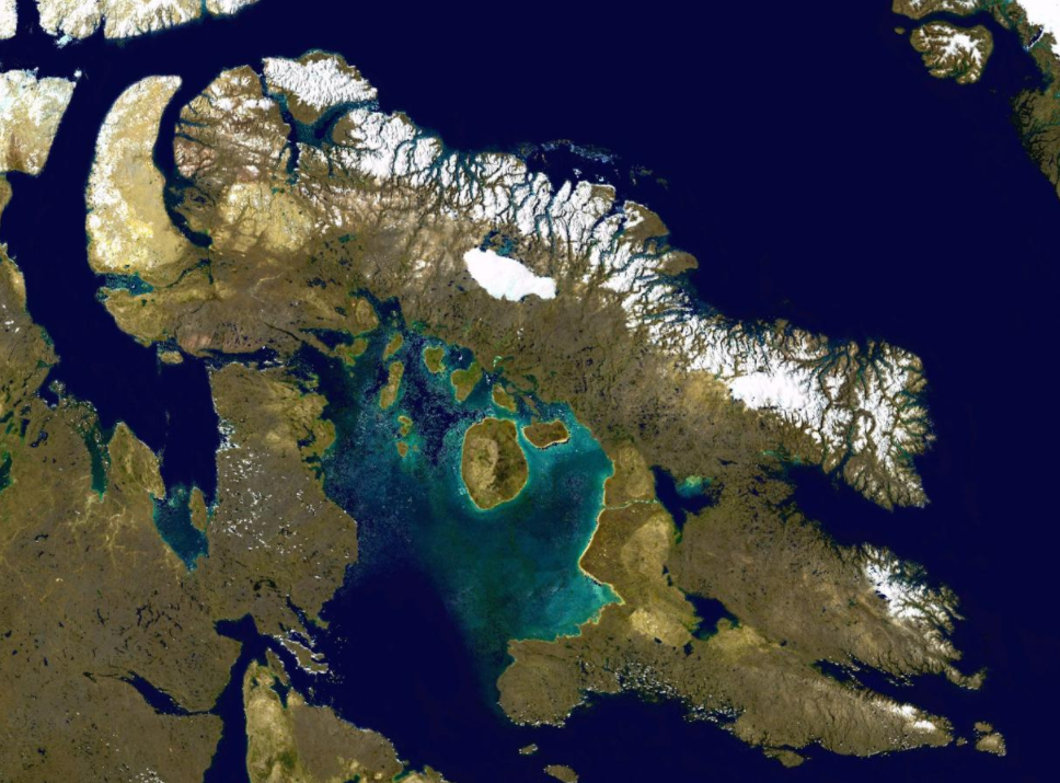
The archipelago extends some 2,400 km (1,500 mi) longitudinally and 1,900 km (1,200 mi) from the mainland to Cape Columbia, the northernmost point on Ellesmere Island. It is bounded on the west by the Beaufort Sea; on the northwest by the Arctic Ocean; on the east by Greenland, Baffin Bay and Davis Strait; and on the south by Hudson Bay and the Canadian mainland. The various islands are separated from each other and the continental mainland by a series of waterways collectively known as the Northwestern Passages. Two large peninsulas, Boothia and Melville, extend northward from the mainland.
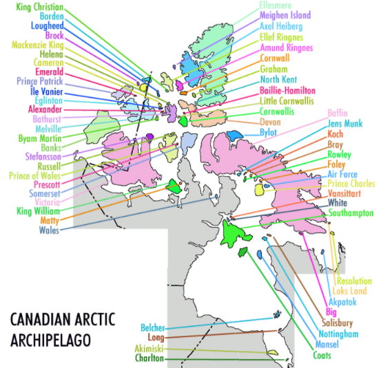
The archipelago consists of 36,563 islands, of which 94 are classified as major islands, being larger than 130 km2 (50 sq mi), and cover a total area of 1,400,000 km2 (540,000 sq mi).[3] The islands of the archipelago over 10,000 km2 (3,900 sq mi), in order of descending area, are:
| Name | Location* | Area | Area rank | Population (2001) |
|
|---|---|---|---|---|---|
| World | Canada | ||||
| Baffin Island | NU | 507,451 km2 (195,928 sq mi) | 5 | 1 | 9,563 |
| Victoria Island | NT, NU | 217,291 km2 (83,897 sq mi) | 8 | 2 | 1,707 |
| Ellesmere Island | NU | 196,236 km2 (75,767 sq mi) | 10 | 3 | 168 |
| Banks Island | NT | 70,028 km2 (27,038 sq mi) | 24 | 5 | 114 |
| Devon Island | NU | 55,247 km2 (21,331 sq mi) | 27 | 6 | 0 |
| Axel Heiberg Island | NU | 43,178 km2 (16,671 sq mi) | 32 | 7 | 0 |
| Melville Island | NT, NU | 42,149 km2 (16,274 sq mi) | 33 | 8 | 0 |
| Southampton Island | NU | 41,214 km2 (15,913 sq mi) | 34 | 9 | 718 |
| Prince of Wales Island | NU | 33,339 km2 (12,872 sq mi) | 40 | 10 | 0 |
| Somerset Island | NU | 24,786 km2 (9,570 sq mi) | 46 | 12 | 0 |
| Bathurst Island | NU | 16,042 km2 (6,194 sq mi) | 54 | 13 | 0 |
| Prince Patrick Island | NT | 15,848 km2 (6,119 sq mi) | 55 | 14 | 0 |
| King William Island | NU | 13,111 km2 (5,062 sq mi) | 61 | 15 | 1279 |
| Ellef Ringnes Island | NU | 11,295 km2 (4,361 sq mi) | 69 | 16 | 0 |
| Bylot Island | NU | 11,067 km2 (4,273 sq mi) | 72 | 17 | 0 |
* NT = Northwest Territories, NU = Nunavut
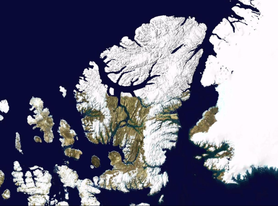
After Greenland, the archipelago is the world's largest high-Arctic land area. The climate of the islands is arctic, and the terrain consists of tundra except in mountainous areas. Most of the islands are uninhabited; human settlement is extremely thin and scattered, being mainly coastal Inuit settlements on the southern islands.
3. Map with Links to Islands
|
https://handwiki.org/wiki/index.php?curid=1701076 |
|
Islands not on map
- Beecheymap 62
- Duke of Yorkmap 63
- Gatesheadmap 64
- Haig-Thomasmap 65
- Hansmap 66
- Herschel Islandmap 67
- Killiniqmap 68
- Jenny Lindmap 69
- Ottawamap 70
- Prince Leopoldmap 71
- Skraelingmap 72
- Trodeleymap 73
- Westonmap 74
References
- "Canada" (in English). World Statesmen. http://www.worldstatesmen.org/Canada.html. Retrieved 30 June 2016.
- "Northwest Passage gets political name change". Edmonton Journal. Archived from the original on 2016-01-16. https://web.archive.org/web/20160121021541/http://www.canada.com/ottawacitizen/news/story.html?id=6d4815ac-4fdb-4cf3-a8a6-4225a8bd08df&k=73925.
- Arctic Archipelago http://www.thecanadianencyclopedia.com/index.cfm?PgNm=TCE&Params=A1ARTA0000292


