Kondur or Kandoora (in Template:Lang-ks; in Urdu: کنڈوراہ) is the largest village in the Sukhnag River valley, located on the eastern banks of the Sukhnag River. It lies on the Beerwah-to-Doodhpathri road and is 26 kilometres (16 mi) from Srinagar, the largest city and summer capital of the union territory of Jammu and Kashmir, which is the southern portion of the wider Indian-administered Kashmir region. Kandoora is a rural village where agriculture is the main economic activity. The majority of its population is Muslim, and their first language is Koshur (Kashmiri), with other languages in use for particular purposes.
- rural village
- kandoora
- kashmir
1. Etymology
The village name, Kandoora, derives from two Kashmiri words: kanie (کَنِۂ), {), and doour (ڈُور}), (). As a whole, this gives the meaning, field of stones, and as the name suggests, the village of Kandoora does have plenty of stones in it.
2. Administration of Kandoora
Kandoora is in the Beerwah subdivision of Budgam district, and governance of Kandoora is by representative democracy. The village is governed by a gram panchayat or village council, according to the 1996 Panchayats Act[1] Its panchayat has 11 members, with each member representing a ward constituency. Each ward has a Ward Representative.
3. Geography
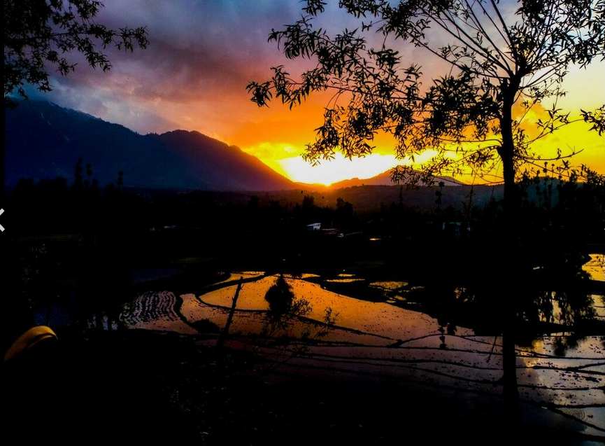
Kandoora is a rural village, one of 102 inhabited villages in the Beerwah tehsil. It has a land area of 199.87 hectares (493.9 acres).[2] Nearest to Kandoora is Beerwah, approximately 2 kilometres (1.2 mi) distant (measured from Beerwah's bus stand), and the Beerwah Tehsil headquarters, about 3 kilometres (1.9 mi) away. Beerwah, along with Sodipora, lies to the north of Kandoora. Also neighbouring the village are the surrounding locations of Sonapah to the northeast; Rankipora and Khatiruna to the east; Larbal to the southeast; Peth Zanigaam and Latinae to the south; Sail and Bun Zanigaamin to the southwest; Kanigund in the west; and Goriepora and Gohlar to the northwest.
3.1. Village Layout
Kandoora is internally divided into Neiber Kandoora (neiber, meaning, 'spread out' or 'peripheral'), and Gamander Kandoora (gamander, meaning, 'downtown' or 'central portion').
Neiber Kandoora has:
- Hajamabad
- Najarabad
- Brandaker
- Gamudd
- Ghatpur
- Sheikhpur
- Malikpur
Gamander Kandoora is composed of:
- Bunpur
- Pethpur
- Mirpur (half)
- Hajamabad (half)
- Najarabad (half)
- Old Graveyard of Kandoora
- Masheed-e-Aungun (centre)
There are several planned or specially built communities within Kandoora. Such communities are widely known as colonies within the subcontinent.[3] The Kandoorian colonies are: Zandwan; Sheikh ul Alam; Gousia; and Larbal.
Village roads
Roads interior to the village include:
- Ghatpur-Masheed e Aungun Street
- Diversion-Malikpur Street
- Diversion-Nagpur Street
- Sheikhpur-Batehar Street
- Gamudd-Maxelum Street
- Maxelumm-Aawrenea Street
- Batehar Street
3.2. Area Road System
Kandoora is well connected to its neighbouring villages by link road. The roads meet internally in the administrative centre, central Kandoora, locally called Masheed-e-Aungun. The roads are:
- Kandoora-Larbal Link road - 1.5 km (0.93 mi)
- Kandoora-Khatiruna Link road - 1.7 km (1.1 mi)
- Kandoora-Latina Link Road - 1.9 km (1.2 mi)
- Kandoora-Zaniegaam Link Road - 2 km (1.2 mi)
- Kandoora-Rankipora Link Road - 1.8 km (1.1 mi)
- Kandoora-Kaniegund Link Road - 1.7 km (1.1 mi)
- Kandoora-Sail Link Road - 2 km (1.2 mi)
- Kandoora-Sodiepora Link Road - 2.4 km (1.5 mi)
- Kandoora-Arizal Road - 11 km (6.8 mi)
The village can be accessed from:
- Budgam
- Budgam-Kandoora Road, via Sonpah
- Beerwah
- Beerwah-Doodhpathri Road, via Sonpah
- Beerwah-Kandoora Road, via Rankipora
- Khag
- Kandoora-Khag Road, via Malpora and Sail
- Khan Sahib
- Kandoora-Khan Sahib Road, via Pethkoot
4. Economy
The economy of Kandoora is generally agrarian, being derived from agriculture and horticultural produce. The horticultural sector is on the rise, with the help of Sher-e-Kashmir University of Agricultural Sciences and Technology of Jammu (SKUAST-J) and Sher-e-Kashmir University of Agricultural Sciences and Technology of Kashmir. Many apple orchards are being developed and this sector is expected to boost the local economy.
The production and sale of Kashmiri handicrafts, such as Kashmiri shawls, is another avenue for earning income available to Kandoorians.
5. People and Culture
The village population is 100% Muslim and includes adherents of Sunni Islam, schools of Hanafi, Salafism, and Barelvi branches or schools of Islam.
Disputes are usually sorted out by local Jirga, an assembly of local chieftains of Kandoora. Jirga is a traditional gathering which has been adapted by Kashmiri Muslims from its origins in erstwhile North-West Frontier Province (NWFP) and Afghanistan.
The mother tongue of Kandoora locals is Koshur (Kashmiri). However, several other languages are occasionally used, including Urdu, English, Persian, Arabic and Hindi.
5.1. Demographics
The majority of adult Kandoora residents work in agriculture and its associated occupations.[2] There are some government employees. Teenagers and young adults may continue as students, attending further education at institutions in the wider district.[4]
| Detail | Total (T) | Males (M) | M as % of T | Females (F) | F as % of T | Sex ratio (no. of females per 1000 males) | Notes |
|---|---|---|---|---|---|---|---|
| Population | 2,774 | 1,492 | 53.8 | 1,282 | 46.2 | 859 | |
| Child (0-6) pop. | 677 | 407 | 60.1 | 270 | 39.9 | 601 | |
| Literacy (Total literacy = 61.56% of pop., aged 6yrs+) | 1,291 | 791 | 72.90 | 500 | 49.41 | 613 | (Those 6yrs+ able to read) |
| In paid work | 707 | 570 | 80.6 | 137 | 19.4 | 240 | |
| Main worker | 130 | - | - | - | - | - | |
| Marginal worker | 577 | 453 | 78.5 | 124 | 21.5 | 274 | |
| No. of households | 479 | - | - | - | - | - |
Source: Census 2011 - 15th National census of India[2]
5.2. Clans
The clans living within Kandoora - without casteism (caste prejudice) - include:
- Ahanger
- Chopan
- Ganiee
- Hajam
- Khan
- Magrey
- Malik
- Malla
- Mir
- Najar
- Pandit
- Parry
- Sheikh
- Syed
- Wani
- Zarger
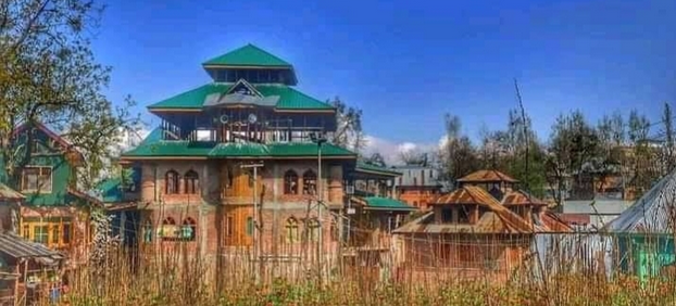
5.3. Religious Institutions and Organisations
The township has halqa level units of:
- Karwan-I-Islami International, Jammu and Kashmir
- Jamiat-e-Ahle Hadith, J&K, Jammu and Kashmir
The village has six masjids, including two jama masjids:[5]
- Grand Jamia Hanafia, Kandoora (in central Masheed-e-Aungun area)
- Chanpur Masjid e Shareef (in Chanpur)
- Masjid e Ramzaan a mosque of the Hanafi school in Sheikhpur
- Masjid e Gousiyah, of the Barelvi school in Diversion colony
- Jamia Masjid Ahlihadith, in Mirpur
- Masjid e Salafiyah, in Ghatpur, a Salafi School masjid
6. Education
The village has a literacy rate of nearly 62% according to the 2011 census.[2] This is somewhat lower than the literacy rate of 67.16 % in Jammu and Kashmir overall.[2]
6.1. Islamic Educational System
The village of Kandoora has three Islamic educational institutions:
- Imam e Azam Institute of Islamic Studies, a Hanafi institution
- Institute of Islamic Theology and Jurisprudence (Urdu: درسگاہ تعلیم القران والحدیث نبویہ)
- Shah e Hamdan Institute of Islamic Studies, named in honour of Mir Sayyid Ali Hamadani
6.2. Independent Schools
- Islamic Educational Institute Kandoora(IES, Kandoora), established in 1986
This institution is the first private school in valley of the River Sukhnaag.[6]
6.3. Post-Primary Schools
- Government Boys Higher Secondary Institute, Kandoora
- Government Girls Middle school, Kandoora
The Government Girls Middle school was established in 1975 in order to educate girls locally, past the primary school level.
The Government Boys Higher Secondary Institute was established in Kandoora 1953 as a primary school. In 1963 it was upgraded to middle school level and then, in 1971, to the high school level. It attained a higher secondary school level in 2018. This higher secondary school feeds Government Degree College, Beerwah. The institute was only the second school in the area, after the Government Boys Senior Secondary Institute School, Beerwah, established in 1953.
6.4. Primary Schools
- Government Boys Primary School, Chanpur
- Government Boys Primary School, Malik Pur
Sports:- 1. Cricket 2. Volleyball 3. Kabadi 4. Kho kho 5. rugby.
References
- "Pincode, Jammu and Kashmir: Budgam - Kandoora". Republic World (India TV News). 24 May 2020. https://www.indiatvnews.com/pincode/jammu-and-kashmir/budgam/kandoora.
- Office of the Registrar General & Census Commissioner, India; Ministry of Home Affairs (2014). "District Census Hand Book, Badgam (Village- and town-wise)" (in en). Census of India 2011: Primary Census Abstract (PCA). Government of India. https://censusindia.gov.in/2011census/dchb/DCHB.html. Retrieved 4 October 2021.
- Macmillan Education.. "Areas in towns or cities - synonyms and related words" (in en). Macmillan Dictionary. https://www.macmillandictionary.com/thesaurus-category/british/areas-in-towns-or-cities. Retrieved 3 October 2021. "Colony (noun; Indian English): a planned area within a city for people to live and work in"
- ((KL News Network)) (18 April 2019). "LS Polls Phase 2: The Complete Story". Kashmir Life. https://kashmirlife.net/ls-polls-phase-2-the-complete-story-207738/. "There were a few instances in Budgam district where the crowds resorted to stone pelting at paramilitary men. At a few places including Beerwa, Kandoora, Chewdara Kawoosa, Ratsun, Nasrullah Pora, Hafrooda, the police did react. Unofficial reports said three persons were injured."
- Jamia Masjid is the mosque in which Muslims observe Friday prayers.
- Directorate of School Education Kashmir http://www.dsek.nic.in/Hill/index.html