Your browser does not fully support modern features. Please upgrade for a smoother experience.
Please note this is a comparison between Version 1 by THEODOROS KARACHALIOS and Version 2 by Camila Xu.
Maritime emissions contribute significantly to global pollution, necessitating accurate and efficient monitoring methods. Traditional methods for tracking ship emissions often face limitations in real-time data accuracy, with wind measurement being a critical yet challenging aspect.
- UAV
- environmental monitoring
- maritime emission tracking
- ArduPilot mission planner
1. Introduction
Maritime emission pollution poses a significant threat to both environmental and human health, contributing to global issues such as climate change, ocean acidification, and air quality degradation. Ships navigating the oceans have achieved relatively low fuel consumption per unit of cargo distance, yet they emit significant amounts of pollutants, including sulfur oxides (SOx), nitrogen oxides (NOx), and particulate matter (PM). These emissions have considerable impacts on both the atmosphere and marine ecosystems. Near coastal areas, maritime emissions are subject to stringent regulations, such as the requirement to use low-sulfur fuel. This makes the monitoring of emissions near shorelines crucial to ensure compliance with these regulations and to mitigate the harmful effects of these pollutants. The importance of closely observing and regulating these emissions in coastal areas is a key component in efforts to protect the environment [1][2][3][1,2,3].
Addressing concerns about air pollution from shipping emissions and observing its upward trend, the International Maritime Organization has set a series of standards and guidelines for the measurement, analysis, and documentation of sulfur emissions from ships [4]. The main purpose is the reduction of environmental and health impacts from air pollution caused by shipping. Central to these efforts is the limitation of the sulfur content of fuel oil, with particular emphasis on emission control areas (ECAs)—zones in northern Europe and North America known for heavy shipping traffic. These regulations cover more than 30% of the air pollution concerns and require ships to run on low-sulfur fuels. In addition, from 2021, ships in the northern and Baltic ECA and northern American ECA must comply with Tier III NOx standards. Especially for liquid fuel tanks, the main strategy for managing emissions includes the use of selective catalytic reduction (SCR) units. It is critical to ensure the effectiveness of these units within the EACs, and for this reason, additional monitoring is deemed necessary. Ships are not only sources of sulfur oxides (SOx) and nitrogen oxides (NOx), but they also emit a range of particulates, including black carbon (BC), organic carbon (OC), ash, and metal aerosols, mainly in the ultra-fine particle (UFP < 100 nm) range. As regulations on particulate emissions are not currently regulated, particularly regarding BC due to its significant climate impacts, increasingly, people are realizing the importance of implementing more detailed and effective strategies for management and oversight. In addition, aerosols, through the photooxidation of SOx, NOx, and OC, impact the coastal environment significantly. The EU has taken additional measures, implementing regulations more strictly for ferries and ships at anchor that go beyond the scope of IMO standards. These regulations require discrete monitoring for sulfur compliance both at sea and in port areas.
However, the implementation of these regulations faces challenges, mainly due to the higher cost of low-sulfur fuels, which cost almost twice as much as high-sulfur alternatives. This is the main reason that creates a disincentive for the shipping industry to comply. In response, national authorities such as environmental and maritime agencies have recently begun to develop remote monitoring technologies to monitor ship emissions in environmental zones (Figure 1). This enforcement strategy serves as a deterrent and documentation of non-compliance, requiring action by local authorities. Fuel sampling at ports is a smart targeting approach using air sampling, which optimizes port inspections. Current solutions for remote monitoring of sulfur emissions include fixed measurement stations that analyze exhaust plumes from passing ships and aerial surveillance, using gas analyzers mounted on helicopters, airplanes, or drones. Airborne surveillance offers advantages over fixed stations because it allows the aircraft to navigate close to any exhaust cloud condensation for better quality air sampling and covers larger areas, conduction unexpected inspections to improve compliance enforcement. The above facts underpin the importance of accurate and reliable monitoring of maritime emissions for enforcing environmental regulations and guiding policy decisions. However, the efficacy of aerial monitoring is inherently tied to understanding and tracking the dispersion of pollutant plumes, which are significantly influenced by wind patterns. Traditionally, emission monitoring systems have relied on predictive wind models to estimate plume trajectories. These models, while useful, often fall short of capturing the dynamic and complex nature of maritime wind patterns [5][6][5,6], leading to potential inaccuracies in emission tracking and assessment [7].
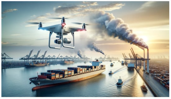
Figure 1.
Artistic representation of maritime emission monitoring mission.
The dynamic nature of the maritime environment presents unique challenges, where wind conditions can change rapidly and unpredictably [8], affecting the dispersion and concentration of pollutants. The reliance on wind predictions, as opposed to real-time wind data, introduces a notable gap in the accuracy and responsiveness of current monitoring methodologies.